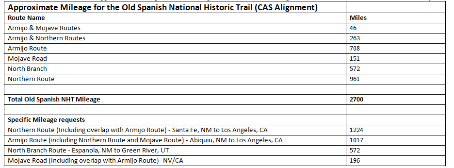
How long is the Old Spanish Trail?
Our partners at the National Park Service prepared this handy chart to show all of the different routes and the length of each segment.
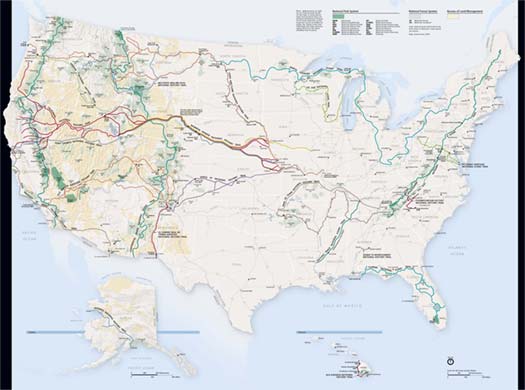
 The scale of this official NPS map of the OSNHT alignment is interactive. https://www.arcgis.com/home/webmap/viewer.html?url=https://services1.arcgis.com/fBc8EJBxQRMcHlei/ArcGIS/rest/services/OLSP_CAS_Line_201801/FeatureServer/0&source=sd
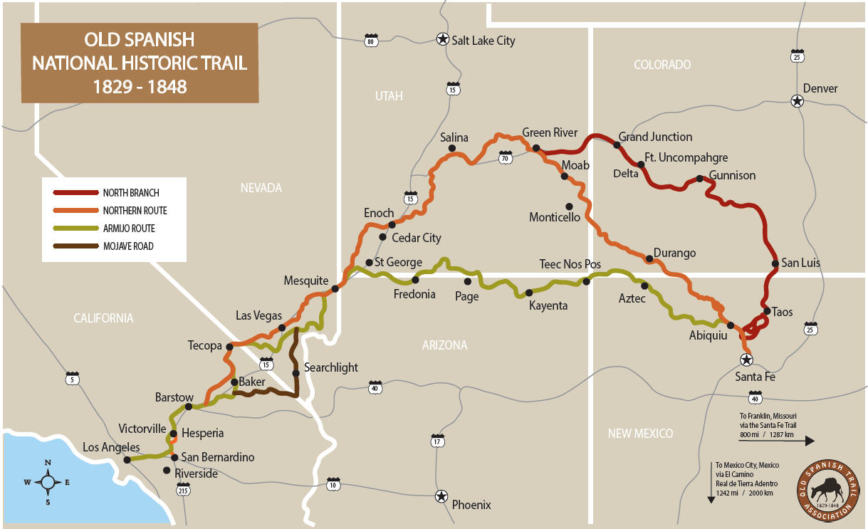
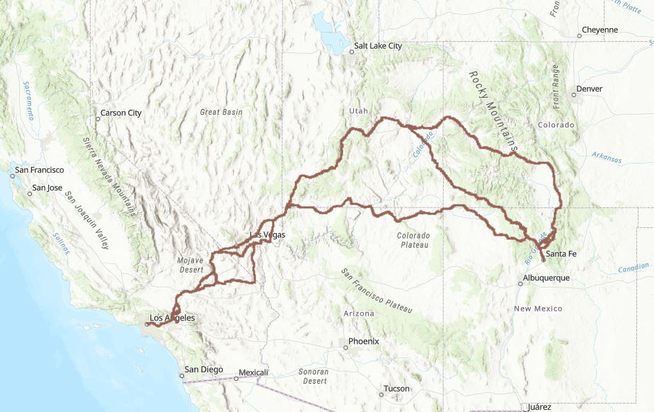
A general map for illustrative purposes (Note: Does not exactly reflect the official trail alignment noted in the 2017 OSNHT Comprehensive Administrative Strategy).
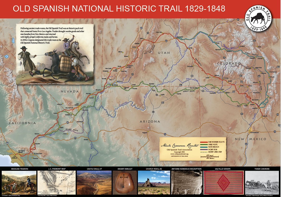
A poster map available for purchase at the OSTA Online Store:
https://ostastore.com/shop/old-spanish-trail-map-poster.html